Here is another area near Tucson to hike, Sabino Canyon. There is an extensive trail system here that are the full range of difficulty from easy to challenging. We went here recently with my sister-in-law and her husband and we enjoyed every bit of our hike.
Sabino Canyon is part of the Pusch Ridge Wilderness Area in the Santa Catalina Mountains. This particular area is very popular so the crowds can be quite heavy especially late winter into spring. There are enough trails that once you get away from the visitor’s center the crowds spread out and you’ll sometimes find yourself alone.
My last hike there took us along Phoneline Trail and Rattlesnake Canyon Trail, but you can choose your own path. We did this hike in early March and to be honest, I didn’t keep track of exactly where we parked to access the trail. There are a ton of places to park so just pull off into a designated area and start hiking.
We hiked just over 4 miles and it was easy to moderate. We did end up at some lovely waterfalls and had many photographic opportunities. Here are just a few:
Sabino Canyon is east of Tucson and is easily found by taking Ina Rd east. It will turn into Sunrise then follow the signs to the entrance. There is an entrance fee. Take note that no dogs are allowed in the park so Fido has to take the day off.
Are you looking for a challenging hike? Romero Pools should be on your checklist! This out and back hike will get your heart pumping with the estimated 1,000 foot elevation gain in only 2.5 miles. Talk about your stair-master! The payoff? Romero Pools.
Montrose Pools
Here’s the low down on this up hill climb. It is a mile from the parking lot along Romero Canyon Trail toward Montrose Pools. This is a great stop off before you attempt the rest of the hike to Romero Pools. Montrose Pools are dry much of the year, but during the monsoons and in the spring you will be treated to a wonderful “mini-Romero” experience.
Romero Pools
Now, on to the hard part (it’s worth it, trust me). Some people claim that this is a moderate hike, but in my hiking journal this is a bear of a hike. For 75% of this trail you will be stepping up and scrambling over rocks. It took two attempts before I actually made it to the pools. When we got there we were pressed for time and weren’t able to spend any time there. The cooler temperatures kept us out of the water as well. With that said, the pools are amazing. The water tumbles over huge boulders then crashes down waterfall. I could have stayed for a couple of hours.
Made it to Romero Pools!
There are a few things you should note before you head out.
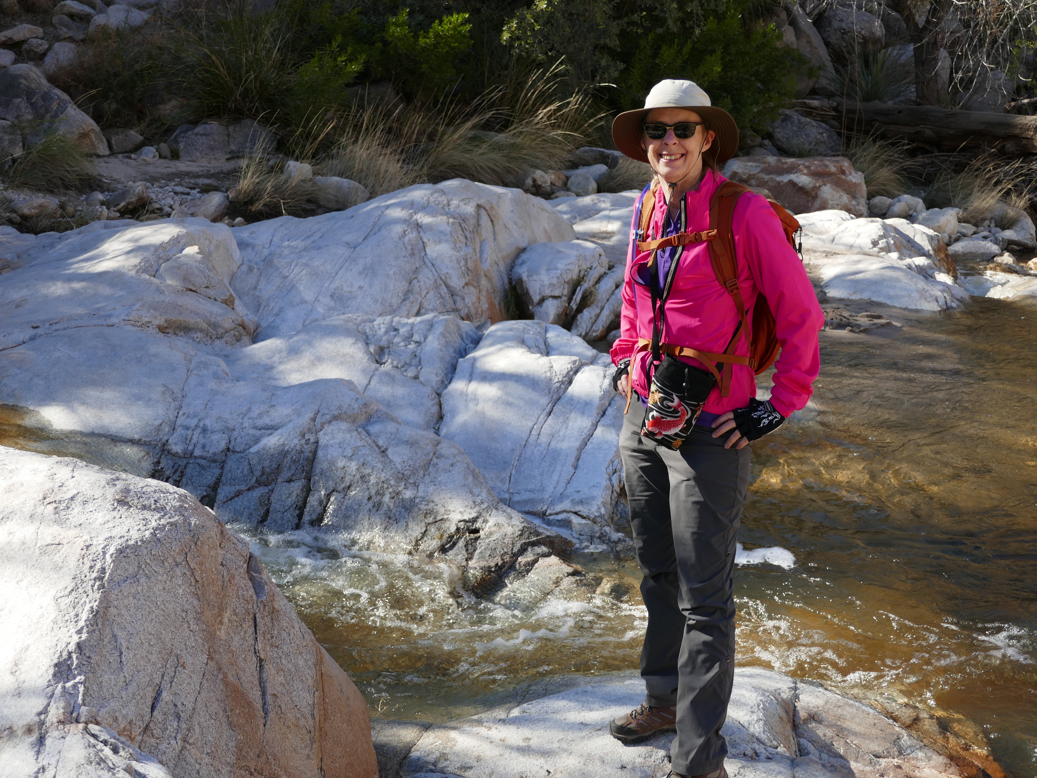
First (and most important) take plenty of water. Seeing people with a single bottle of water makes me worry. Desert hiking is DEHYDRATING. Your body will lose more water than you can imagine and fast too. We don’t head out with less than 2 liters (about a half gallon) of water each, along with at least a quart of hydration water. If the temperatures are going to be above 80 degrees we take even more.
Second, leave Fido at home. This is a wildlife management area for the big horn sheep. You can have Fido with you up to the turnoff point of going up to Romero or right to Montrose, but no further. You’ll see the signs.
Third, you have to cross Oro Canada Wash which will have foot soaking water in it about half the year. You can take off your hiking boots to cross barefoot, or bring a couple of bread bags to put over your shoes to keep them dry.
Getting here is easy. Just take Highway 77 (Oracle Road) to Oro Valley, AZ. Catalina State Park is well marked. There is an entrance fee. The parking lot is large and the road also has room to park along when the lot gets full (usually in the spring on weekends). The trailhead is right off the parking lot. Total out and back is 7.3 miles.
What a find! This is one of the quietest hiking areas I have been to here in Arizona. Not only is there no traffic noise, but there is little foot traffic.
When arriving to the park you are greeted by the Mediterranean style Kannally Ranch House built in the late 1920’s. It is open to the public to wander through the rooms which have the history of the building on display. The smell of old paper and the creaking of the wood plank floors will take you back in time. My suggestion is to enjoy one of the many hikes throughout the park then wander through the ranch house after. With tables in the shade, and a lovely garden on a lower level it is the perfect end to a great hike.
The hikes are under a wide open sky varying between easy and moderately easy. If you are looking for a challenge you may want to head over to Catalina State Park and do the Romero Pools Trail. What I like about these trails is the length of the trails which range from the simple 1 mile Nature Trail loop to 10 mile out and back trails. Our personal favorite is the Windmill Loop. Until we found our bearings, it took a few trips to actually get to the windmill.
On occasion, the park is open after dark for Night Skies. The night shy has a little bit of light pollution out of Tucson, but not enough to interfere with the beauty of the Milky Way. Call ahead to see when the park is open for star gazing.
The shade there is limited so be sure to wear a hat and have plenty of water if the day is hot. Oracle State Park is at 4500 feet so the temperatures are a little cooler than down in Tucson. To reach the park take Highway 77 (Oracle Road) north out of Tucson to Oracle, AZ. Follow the signs to the park entrance.
Nelson Lake is a tiny spit of a lake nestled in a quiet corner of Kane County, Illinois. It is a marsh nature preserve with an easy walking trail that circles it. Last year I visited my sister who took my husband and I to enjoy the perfect weather, fall vibrancy, and the large number of water fowl that enjoy the lake on their migrations south.
If you are ever in the area, this is a lovely place to take a break from the hustle of daily living. You will enjoy the rustle of the breeze sifting through the grass and the call of geese, swan, and heron.
Nelson Lake is about 35 miles east of Chicago near Batavia, Illinois. We accessed the park from the small lot off Nelson Lake Road. The path leading out is easy to find. Everyone of any age will enjoy this flat, 2.5 mile loop.
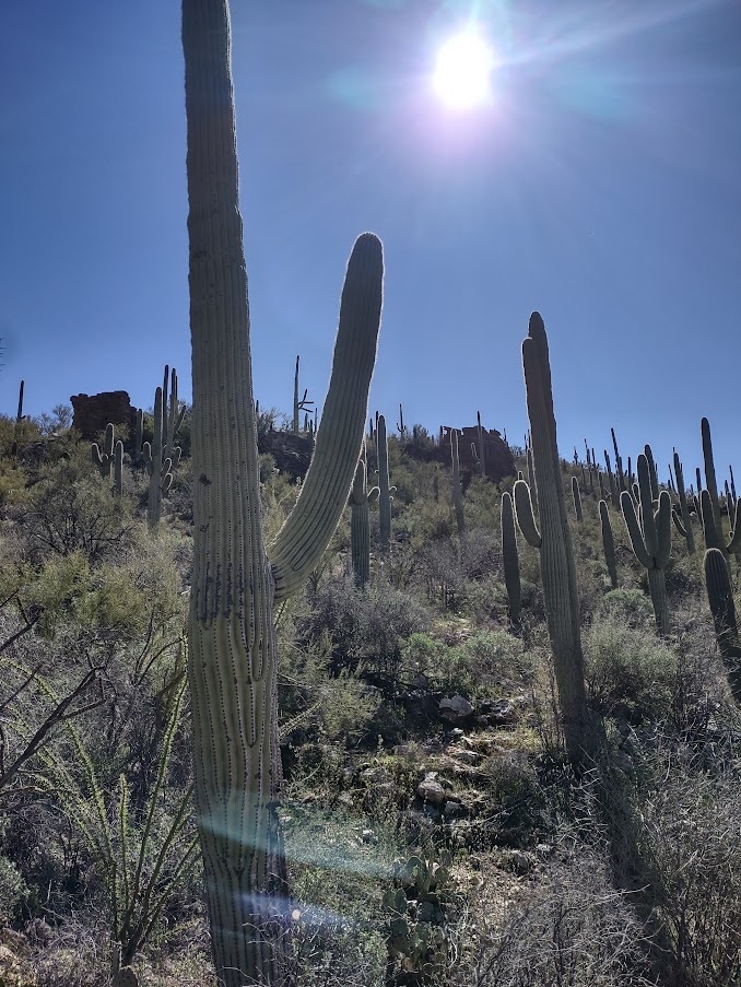
Rincon Mountain District (Saguaro National Park East)
The Douglas Spring Trail hike can be as easy or hard as you would like depending on the direction you go. Because we had a time constriction (a reservation for lunch) and we had never hiked here before, we decided to start out conservatively so we took the Carrillo Trail initially.
The first two miles were essentially flat and we were pretty much by ourselves. It was a nice break from the tougher hikes we have been on this year. The trail wound through saguaros, cholla, and ocotillo. We kept an eye on our time and were concerned we might not get around the full loop in time for lunch.
We backtracked and took a right back at the junction to follow Douglas Spring Trail and headed up, and up, and up. It has about a 400 foot elevation gain although this felt like 2,000 feet at the rate we were going. This part of the hike was rocky with a few scrambles and was actually really crowded. I was a little disappointed with that. I do need to keep in mind that the national parks here are very popular especially during the Spring break time periods. OK, plus it was a Saturday.
To get to this area of Saguaro East just take Speedway straight east. although there are a few dead end signs that just means you are getting closer. Parking is just before the entrance to Tanque Verde Ranch (fun place to eat and take in a little ranch atmosphere). Get there early to get a place to park. If the lot is full there is also street parking.
As promised, I am going to take you all on a tour of the the various trails we have hiked in Staunton State Park, starting with Mason Creek Trial. We hiked this in July, but we were lucky to have gone on a cooler day. The trail is mostly in the trees, but much of it is also wide open.
Trail is a mix of packed dirt and rocks to scramble over.
Mason Trail is highlighted in green running on the right side of the map. We stopped at Catamount Overlook.
The 7.4 mile out and back stretch we took is a mix of easy to a more moderate incline with a few little rocky scrambles. You can reach this trail from any of the parking lots by staying to the right of the trails that lead out. We parked in the Mason Creek lot and went from there. If you want to stick to the easy portion, only go as far as The Raven Climbing area right at the Mason Creek Cascades. This is a pretty spot for a creekside picnic and there are usually climbers here to watch.
One of the climbing areas at The Ravens. See the arrow on the bottom left to give you a scale of a climber getting ready to start.
From here the trail is a steady incline through the woods and open spaces with plenty of opportunities for vista viewing. There are a number of horses that use this portion of the trail system along with bikes so keep an eye out and share the trail.
We called our hike once we reached Catamount Overlook. From here you can continue onward for another four miles to reach Old Mill Site. There is a cut through from Old Mill back down to the main Staunton Ranch Trail.
To get to Staunton State Park take Hwy 285 south to Shaffers crossing (it’s about 6 miles west of Conifer). There is a sign right on the highway so you can’t miss it. You turn right onto Elk Creek Road and go about 1.5 miles to the entrance of the park. There is an entry fee of $9.00, but if you visit Colorado’s state parks with any frequency, their annual pass is the best choice.
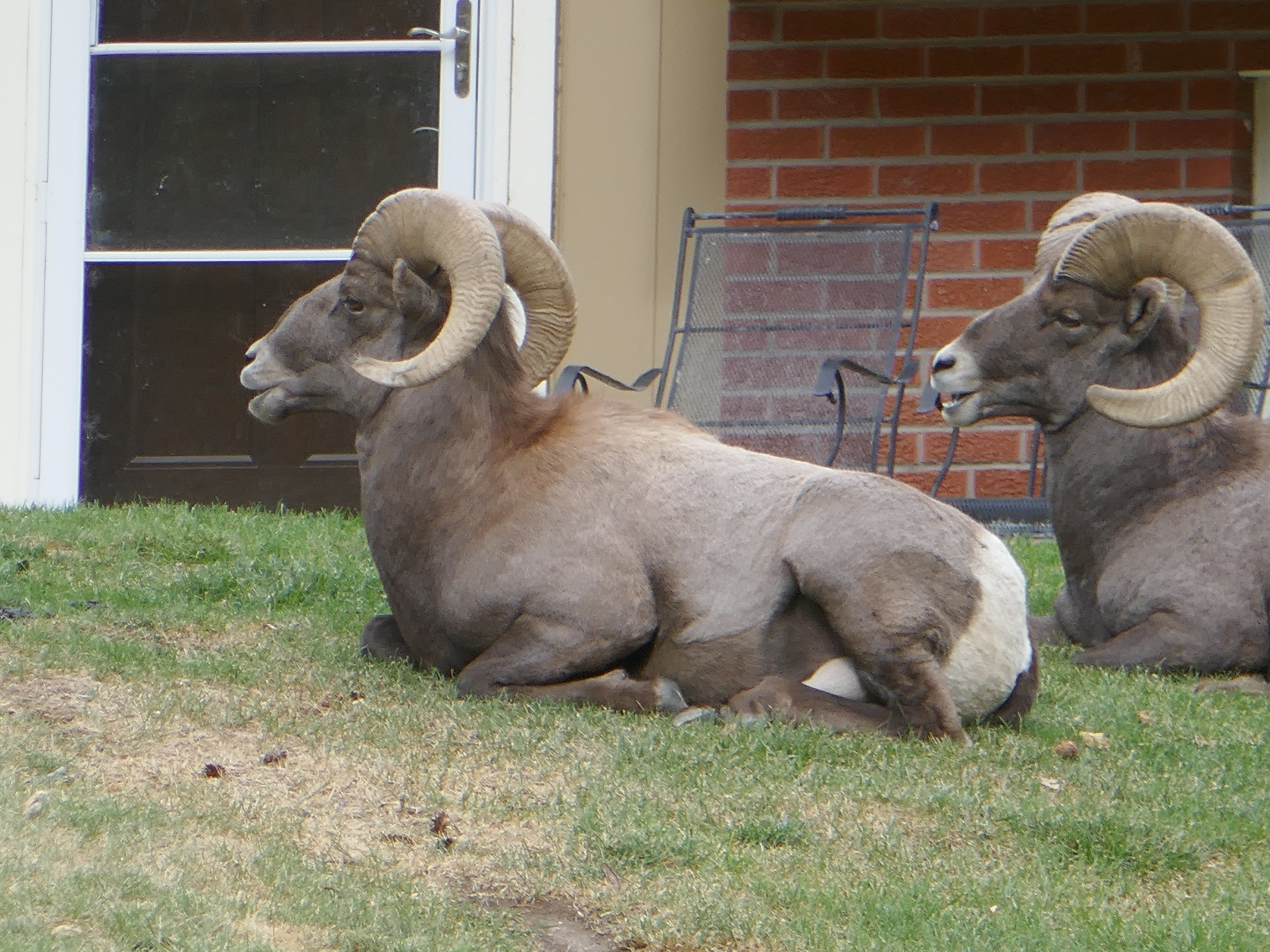
What a great experience to see bighorn sheep up close, and personal. When I read that Waterton Canyon was a great place to see them, I imagined them being up on the hillsides, not fifteen feet away.
Waterton Canyon Trail follows the South Platte River.
Let me share the hike with you, then tell you my sheep story. The hike itself is what I’d categorize as very easy. It is along a dirt road that follows the South Platte River and used by the Denver Water Department to service the Strontia Dam at the top of the trail. If you hike this be aware that there are vehicles sharing the road with you. It is not open to the general public so the cars are minimal. The bikes are not. This is an excellent out and back quick ride for bikers so there are quite a number of them. I hiked this on a Tuesday so it wasn’t as busy as weekends.
The incline is steady, but hardly noticeable. I saw someone pushing a stroller, young children on bikes or walking, along with a gentleman riding an electric handicap scooter (he was at mile three photographing the bighorn sheep). You can hike the full 12.4 out and back, or continue on up about another 4 miles where the Colorado Trail connects (bikes are not allowed past the dam). I only went to mile 3.5 where the first of the bighorn sheep were lounging in someone’s front yard.
This is the point where I stopped at a picnic table and had a snack before heading back down where I had my second encounter with the bighorns.
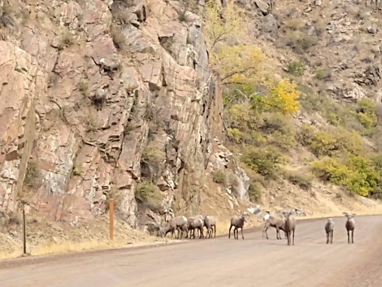
About halfway down I came across a herd of about eleven bighorns. They were on the younger side compared to the group lounging in the yard. They seemed to be heading the same direction as I was which felt a little disappointing as I wanted to get a few photographs. They must have heard my thoughts because, after a couple of them bounced around on the rocks the group started up the road in my direction.
The lead bighorn slowly made its way toward me, boring a hole through me as it was deciding if I was a friend or foe. The others walked slowly behind. I wasn’t exactly sure what to do so I moved off the side of the road and kept a side eye on the group. When they got about 15 feet away they decided it was safe to pass, at full speed.
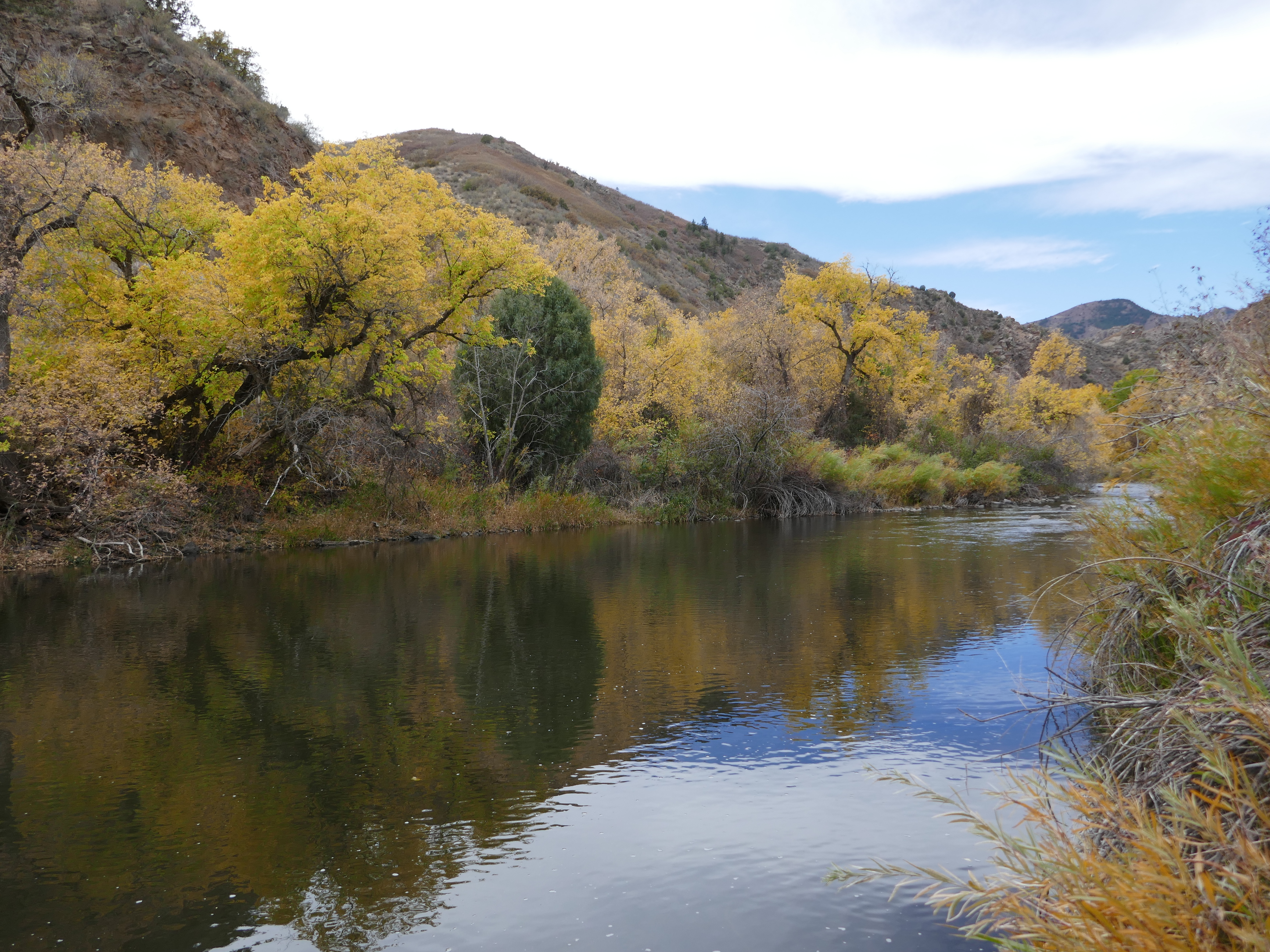
Not only were bighorn sheep grazing the canyon, but the fall colors were still putting on a show. I missed the scrub oak by a couple of weeks, but the cottonwoods were a beautiful golden yellow. Mixed in with all the activity were the fishermen who seemed to be having a bit of luck too.
Waterton Canyon is easily accessed from C-470 and Wadsworth (Hwy 121). Take Hwy 121 south off C-470 to Waterton Canyon Rd. The intersection is well marked. The large parking lot is right off Waterton Canyon Rd. This is a heavily used area on weekends so arrive early to beat the crowds.
Sandstone Ranch Open Space Park is a new, Douglas County park that opened late September of 2020. It is about 3 miles west of Larkspur, Colorado. Douglas County secured this land in 2018 and opened the area to the public in September of 2020.
We hiked on a Sunday, two weeks after the park opened and, by coincidence, we arrived just as the last of about 40 horse trailers parked. As it happens, this was an equestrian club that normally would not have been there. At first we were worried the trails would be crowded with horses, but there was plenty of space for all of us. We did run into one larger group, but otherwise they were nicely spread across along the trail.
The trailhead is right off the parking lot through a gate. (There are several around the loop. Because this is still a working ranch be sure to close each gate as you pass through). The 3.8 mile trail (4.5 from where we parked) is well maintained and wide enough to pass anyone along the way. It is loose dirt and sand (something to keep in mind if you hike after a rain or snowmelt). I would rate the trail as easy, but if you do go clockwise the initial climb might make it a moderate.
Brian, president of the Douglas Land Conservancy, happened to be the greeter the day we hiked, and advised us to go counterclockwise rather than the other direction. Why? “Because everyone goes clockwise.” After hiking it, I agree. The elevation climb is minimal (about 400 feet) and if you go clockwise it is all done in the first mile.
Much of the hike is open meadows with Pike National Forest as a backdrop against sweeping vistas. The scrub oak was a brilliant contrast of orange, yellow, and red against the dark greens of the pine trees of Pike. Beautiful. The area felt wide open through the meadows along with shady spots as well.
Getting to Sandstone is easy. From I-25 take exit 173 at Larkspur. Turn west at Perry Park Avenue and follow this for about 3 miles. At the T-intersection turn left onto County Hwy 105. The entrance to the trailhead is on the right about 1/2 mile from Hwy 105 and Perry Park Ave.
We recently discovered this beautiful park which is part of the Colorado Park and Wildlife system. Staunton State Park is 3,918 acres of land which was donated to the state by the Staunton family in 1989 and opened to the public in May of 2013.
Staunton Ranch Park trail map provided at the entry gate.
The trail system is extensive and open to all levels of hiking, biking, and horseback riding along with a number of climbing areas if you are a fan of rock climbing. There are a few trails that are only open to hikers, but most are open to all.
The park also offers a wonderful opportunity for anyone who is physically disabled. The Track-chair Program opens the door to everyone and takes visitors along three trails with water features, open meadows, forest, and views! Visit CPW’s website for more information and reservations.
The weekends are quite busy so I recommend visiting the park during the week if you can. We have been three times (Sunday and two Fridays) and were treated to some solo hiking for a few long stretches on the Fridays we were there.
There is one drawback I found to this park. Not enough trails are hiker only. The bikers are, for the most part, polite and yield to hikers, but there are the few that go too fast and have the manners of a banana peel on the ground.
The park does have a bell system so bikers will jungle as they ride, but after three visits to the park, only one biker used it. Why? There are no bells available in the bell box at the trail head. I assume they have all been taken by visitors and not returned. The park is heavily used by bikers so be sure to get off the bike trails if you are hiking. I personally would like to see more trails dedicated to hiking only.
I will write more on the individual trails we hiked later, but I will say, this is a gorgeous place to hike. There is a great mix of pine forest, aspen groves, and open meadows. The trails are well maintained and clearly marked. The staff is friendly and greet you with a smile and have extensive knowledge of the area.
To get to Staunton State Park take Hwy 285 south to Shaffers crossing (it’s about 6 miles west of Conifer). There is a sign right on the highway so you can’t miss it. You turn right onto Elk Creek Road and go about 1.5 miles to the entrance of the park. There is an entry fee of $9.00, but if you visit Colorado’s state parks with any frequency, their annual pass is the best choice.
Monarch Lake trail system has several options to choose from to satisfy any hiker. Monarch Lake Trail is an easy 4.2 mile hike that winds around the circumference of the lake. The single track trail is mostly flat with a few rocky stretches. Perfect for even the youngest hiker. On leash Dogs are welcome, but remember to pack enough water for you and your fury friends.
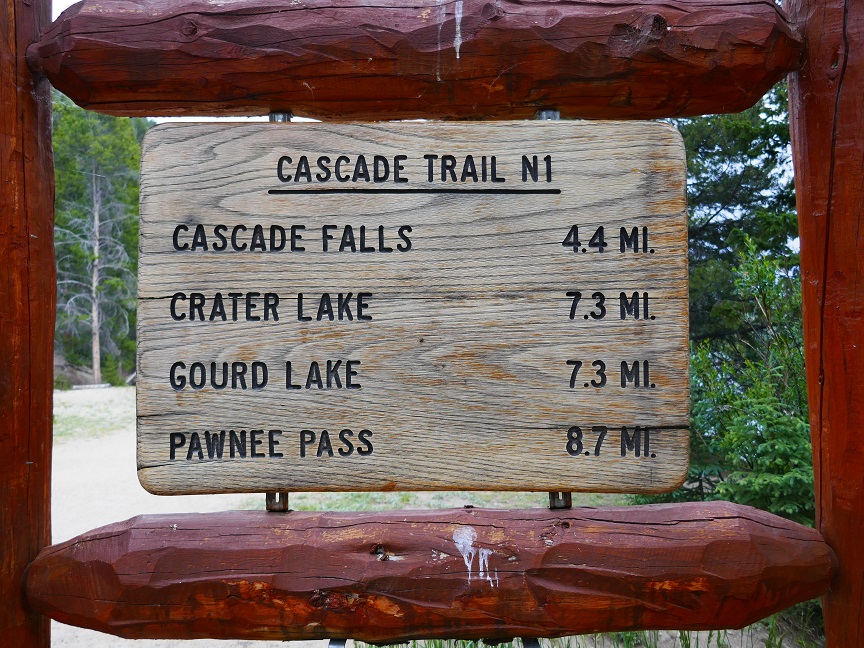
Monarch Lake
Close to the half-way point along Monarch Trail, you can either go all the way around the lake, turn back, or head off to the left, onto Cascade Falls Trail. If you take Cascade Falls Trail, you are in for a hard hike (8.8 miles round trip including the Monarch Lake Trail portion), but the top of the trail is so worth it. Depending on how far you actually go, this trail accesses Crater Lake (7.3 miles), Gourd Lake (7.3 miles) and Pawnee Pass (8.7 miles) where there are areas for camping.
The trail head for Monarch Lake is the beginning of several trails.
We hiked up Cascade Falls Trail and the ascent started right off. As I said before, this trail is rated difficult and I agree that going up is quite a challenge. The altitude gain is enough to warrant a hot air balloon filled with spare oxygen. We are in good physical condition, and by the time we got back down to the base we were well worn. If you are not, know your limits. You have to get all the way back to the car so turn around before you are exhausted.
The hike up follows Cascade Creek. Depending on the time of year, the creek can be swollen with snow melt, or tumbling over the rocks later in the summer. Today the creek ran pretty high so we were treated to sections of wild running rapids (nothing to ride a tube down!).
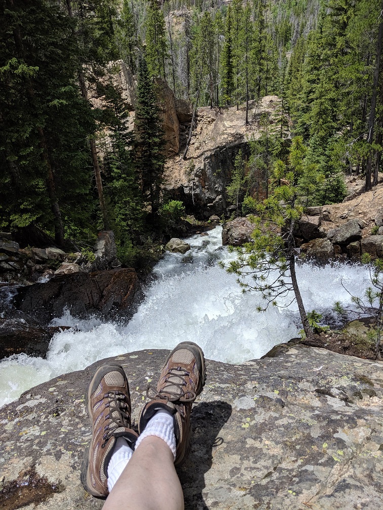
There were plenty of spots to rest along the way, most above the creek, but still within earshot of the roar. We enjoyed three stops along the way. One was a little perch above the creek and another was creek-side. We initially thought this might be Cascade Falls. Out of curiosity, we continued up the trail and were rewarded with the falls. You will cross two bridges on your way up to the falls. Once you cross the second one you are getting pretty close. At least within a half mile.
Taking a break at the top of Cascade Falls.
There are essentially two sections to the falls. One spot to view them is near the base of the falls themselves and the other on top. We rested on top for about an hour before we trekked back.
If you happen to do this hike, keep an eye out for a pair of women’s prescription glasses. I discovered I lost them about a mile down the trail. We went back up (adding about 2 miles to our hike) to look for them, but I fear they landed in the river at some point.
Monarch Lake’s trail system is fairly easy to get to from either Granby or Grand Lake. You will be in the Arapaho National Wilderness Area and will need a day pass. Bikes are not allowed on these trails.
Be ready for a thick layer of dust on your car. It’s a 10 mile drive on a dirt road. The parking lot is on the small side. It accommodates maybe 40 or 50 cars, but there is plenty of space to park along the road as well. This is a popular area to hike in so get there early to find a spot to park. We arrived in the afternoon (on a Saturday) and were lucky to get on of the last spots.
Directions: From Granby turn north onto U.S. Highway 34, travel approximately six miles to County Road (CR) 6. Turn east onto CR 6 (Arapaho Bay Road/NFSR 125), and drive 10 miles to the parking area.